City to Conduct Aerial Survey to Map Aquifers
Published on July 22, 2025

The schedule for the City of Kalamazoo’s airborne electromagnetic (AEM) survey of aquifers is being updated. The survey is expected to start on Monday, August 4, and continue through the week.
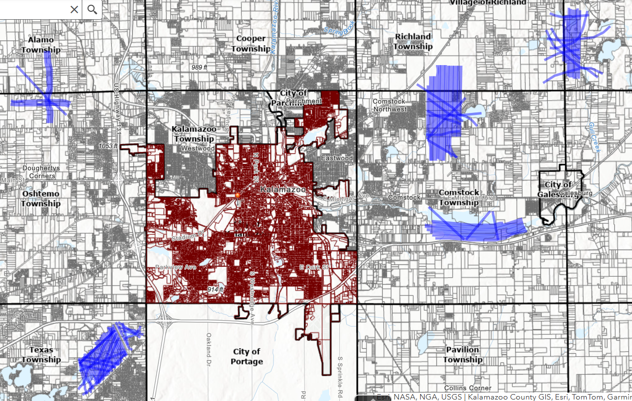
The City of Kalamazoo will conduct an airborne electromagnetic (AEM) survey of aquifers in parts of Texas, Oshtemo, Comstock, and Ross Townships starting as early as Monday, August 4 (Rescheduled from July 28), and concluding within the week. This initiative aims to enhance groundwater mapping and improve water resource management.
The survey will involve a helicopter towing a hexagonal antenna approximately 100 feet above the ground. The antenna transmits and receives signals, allowing scientists to characterize subsurface geology and locate buried glacial aquifer deposits that supply groundwater.
None of the instruments carried beneath or on the aircraft pose a health risk to people, animals, or plant life. No photography or video data will be collected.
“Our groundwater investigations will benefit greatly from this AEM survey,” said Public Services Director James Baker. “Traditionally, we’ve relied on drilling test wells, which is an expensive and time-intensive method. With AEM technology, we can collect valuable 3D data efficiently across large wellfields, helping us make more informed water management decisions.”
The helicopter flights will cover approximately 1,620 miles over the five wellfields, following a grid pattern with east-west trending flight lines spaced 500 to 2,000 meters apart. The survey will cover a total area of 1,450 square miles.
The study is being conducted in collaboration with Aqua Geo Frameworks, LLC (AGF), a leading airborne geophysical survey company, and its affiliates. The flights will be performed by LiveWire Aviation, whose pilots are specially trained in low-level flying for geophysical studies. The survey will be conducted in compliance with Federal Aviation Administration (FAA) regulations. Since data can only be collected over open spaces, no data collection will occur over residential areas, livestock feeding areas, or other buildings.
“The data collected will help us better assess how to protect existing groundwater supplies and evaluate the potential impacts of new wells on the aquifer,” Baker continued.
The AEM system, developed by SkyTEM, is capable of mapping geologic structures and groundwater resources up to 900 feet below the surface. This technique has been used for mapping of glacial aquifers in Nebraska, Iowa, North Dakota, Indiana, and Illinois, and has been shown to provide useful information that can be used to better manage the natural resources.
Groundwater is the source of water in the Kalamazoo County area, and improving our knowledge of the aquifers will help the city of Kalamazoo to determine how best to protect our existing groundwater supplies as well as better assess the impacts of new wells on our aquifer(s). Following the flights, AGF will analyze the data to create a 3D hydrogeological framework, which will support future municipal water planning and management efforts.
A media opportunity will be available next week at the Plainwell Airport for reporters interested in speaking with the project team and viewing the helicopter and surveying equipment up close. The visit will be coordinated based on interest and the flight schedule. To express interest, please contact the City of Kalamazoo at 311 or (269) 337-8000.
Survey Locations
The flight paths are shown in blue on the map below: