Historic Districts

There are six local historic districts in the city of Kalamazoo. Our local historic districts must meet the same standards for historic integrity as National Register Historic Districts, but with an additional layer of local review by the Historic District Commission. Kalamazoo also has 11 single resource historic districts.

You can view historic district maps below, or by using GIS Maps. Visit the City of Kalamazoo's GIS Mapping service and turn on the Historic Places layers. The layers button is located in the top right of the GIS window and Historic Places is located in the General Information layer. 

Haymarket Historic District

Development began in the Haymarket district as early as the 1830s. It was spurred by the construction of the Grand Rapids and Indiana Railroad Depot in 1870. The district became a hub for retail, wholesaling, and light manufacturing. It was the business center for the German community. The Desenberg Block at 251 East Michigan Avenue is Michigan’s only surviving example of the work of Chicago architects Dankmar Adler and Louis Sullivan.

Haymarket Historic District Map

Rose Place Historic District

Rose Place Historic District Map

South Street Historic District

Today nestled between the business district and college campuses, this tree-lined neighborhood recalls a quiet but prosperous Kalamazoo at the turn of the century. The street was platted in 1841. Its beautifully preserved houses, which were built between then and 1915, reflect the spectrum of fashionable domestic architecture of the period with the Italian Revival style most prevalent.

Many prominent middle-class families lived in this neighborhood, which runs two blocks along South Street. Here were the homes of professors, lawyers, journalists, businessmen, and others active in the civic, commercial, and professional life of Kalamazoo. Today the district houses community service organizations as well as businesses and families, thereby retaining its traditional cultural and civic orientation.

South Street Historic District Map

Stuart Historic District

Wealthy merchants and businessmen seeking an escape from the hurried life of downtown living built this prosperous neighborhood in the latter half of the nineteenth century. Movement to the suburbs gained in popularity after the 1850s, but lack of transportation hindered rapid development. The early suburbanites were mostly well-to-do and could afford to be a few minutes late to work if their buggies got stuck in the mud or snow. With the installation of horse-drawn trolleys in the 1880s, the middle class began to move here.

Homes of this neighborhood reflect the individuality and at times the economic status of their original owners. These homes were designed in the architectural styles of the mid and late nineteenth century. They range from the fashionable Queen Anne, the most popular during that era, to the Renaissance-style architecture which also flourished at this time. Many of the residences feature Italian, Gothic, and Greek influences. This district is one of the city’s earliest suburbs.

Charles Stuart, a politician and lawyer, started this residential area with the building of his Italianate house in 1858. Illinois Senator Stephen Douglas visited the Stuart home, which was one of the first on the west edge of the village of Kalamazoo. Later, as the neighborhood developed around that site, Stuart opened Douglas Avenue, which he named in honor of his guest. Most of the early residents of this area, then a suburb, were prosperous businessmen and self-employed craftsmen.
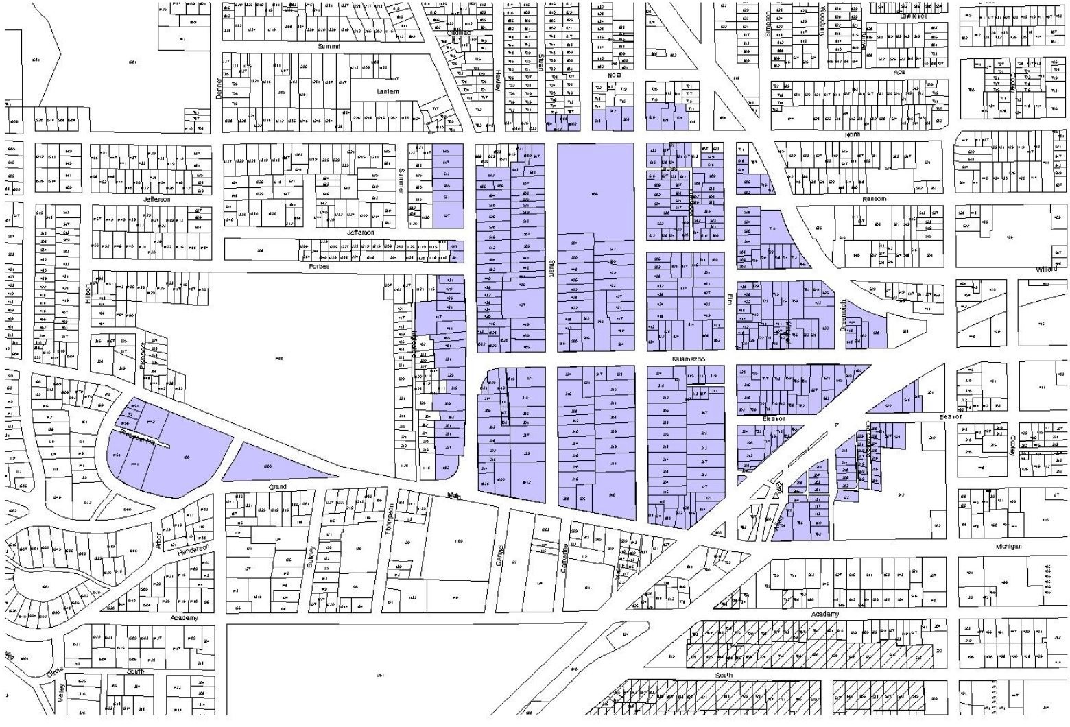
Stuart Historic District Map

Vine Historic District

Vine Historic District Map

West Main Hill Historic District

Businessman Frank Henderson capitalized on the topography when he platted the West Main Hill neighborhood. The naturalistic plan features curving, tree-lined streets and deep setbacks. Although platted in 1888, West Main Hill did not fully develop until the early twentieth century when motorized transportation eased residents’ commute to the city’s manufacturing and business centers. The district, which is listed in the National Register of Historic Places, is bounded by West Main Street, Mountain Home Cemetery, Kalamazoo College, and the city limit. The houses exhibit a variety of architectural styles and range from modest bungalows to the opulent Henderson Castle on the neighborhood’s highest point. 

West Main Hill Historic District Map

Single Resource Local Historic Districts

  • Ladies Library Association, 333 S Park Street
  • Michigan Central Railroad Depot, 459 N Burdick Street
  • Kalamazoo State Hospital Gate House
  • Kalamazoo State Hospital Water Tower
  • Western Michigan University, The Oaklands, 1815 W Michigan Ave
  • David Lilienfeld House, 447 W South Street
  • Marlborough Apartments, 471 W South Street
  • George Nelson's Kirkpatrick House 
  • Citizens Street Railway Car Barn
  • Rickman Hotel, 345 N Burdick Street
  • First Baptist Church, 315 W Michigan Avenue